
Here’s a closer look at East Wilson. The streets north of Vance, except Lipscomb, were white residential, as were Railroad Street and Pettigrew Street (not labeled) south of Nash.
Town limits ran just behind Darden (then Wilson Colored) High School at roughly today’s Blakewood Street; south roughly along today’s Wainwright Street to Nash Street (at Freeman Round House Museum); then at a diagonal across Finch, Lane, New Bern Streets, etc.
Note School Street (named for the Colored Graded School), which became Elvie Street.
Just west of the railroad were a working-class white neighborhood centered along Factory Street (which no longer exists) and a working-class black neighborhood, Happy Hills, centered at Banks and Lodge.
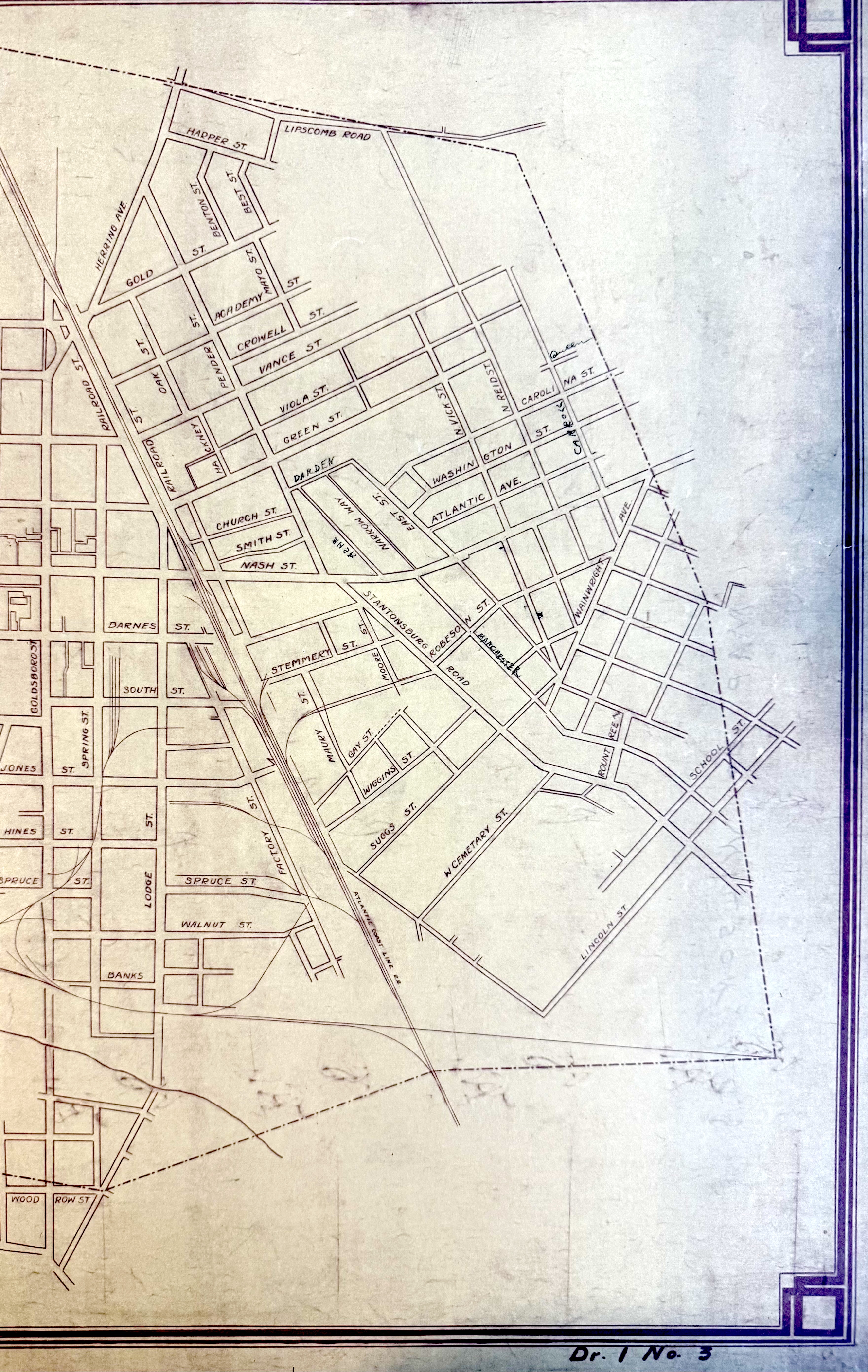
Town of Wilson (1928), Maps, Wilson County Records, North Carolina State Archives.