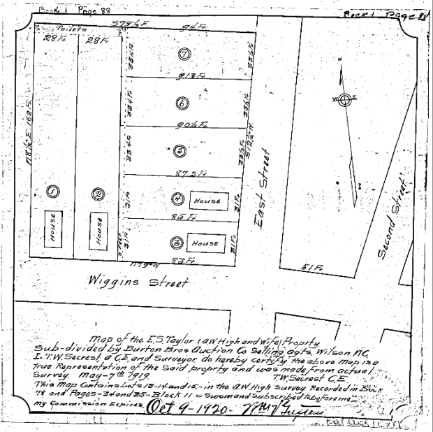
In 1920, an auction house commissioned the survey of part of a city block in East Wilson owned by E.S. Taylor. The parcel contained seven narrow lots, four of which already held endway (“shotgun”) houses. A three-foot alley spanned the rears of lots 3 through 7 offering access to the row of shared toilets at the back of lots 1 and 2.
Here is the block in the 1922 Sanborn fire insurance map of Wilson, turned about 90 degrees to the right.

As noted elsewhere, there is no longer a Wiggins Street in Wilson. It was obliterated as part of the construction of Carl B. Renfro Bridge and the extension of Hines Street (which runs along the old course of Wiggins) to meet East Nash Street.
None of the houses shown in the Sanborn map now exist. And none of the houses shown in the Google Maps aerial view existed in 1922.


