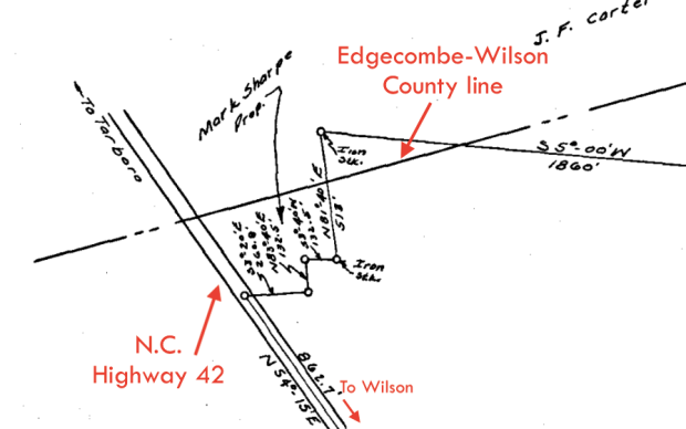
Detail from the W.M. Wells property in Gardners township, Wilson County, and Township Number 9, Edgecombe County.
This 1954 plat map shows a small irregularly shaped parcel of land wedged between the Edgecombe County line and W.M. Wells’ large farm that belonged to farmer and activist Mark B. Sharpe.
Plat book 5, page 132, Register of Deeds Office, Wilson.

I don’t understand the orientation of the map, NC Highway 42 runs from southwest to northeast.
This is the orientation the surveyor (or his map drawer) used, presumably to fit the entire property onto the page.
Got it, thanks.